JRS7
UKC Forum Member
Registered: Aug 2011
Location:
Posts: 14 |
Re: Yes, it is very similar to Google Earth
quote:
Originally posted by Tim MACHA
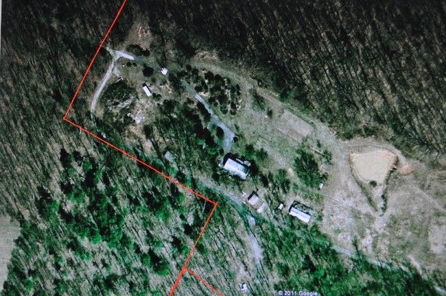
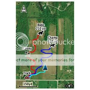
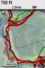
It works really great in combination with the topo card. Keep in mind that your Garmin screen is smaller in size, but the images are pretty clear. I can watch the dogs work around a field and I can see a group of trees in the corner. I can watch the pointer as they enter them and see if they blow right on through or work around it. After using it, I would hate to go back to watching a 220 screen. Another nice thing is the blue lines showing streams on the topo card may not be exactly where the stream really is and BirdsEye is right on. The downloads are probably 3 to 5 years old, so it may show a fence that has been pushed out that is not there anymore, or a new house that has been built since.
WOW!! Time to dig into savings.......
Am I correct in the assumption that the images are the exact same ones that GoogleEarth uses, with only the limitations of the smaller screen on the Garmin changing them at all? (Can't imagine that there are more than one set of photos of the entire earth floating around....)
Sitting here looking at GoogleEarth, can't imagine how cool it would be to 'see' my dog going across the map, through the trees, across the river, ect. I don't think much changes where I hunt, the maps would be pretty accurate.
I can hear myself now: "Honey, I know I spent a lot on the dog, but this Garmin thing would make it so much easier. I might even get home earlier." (Fingers crossed behind my back on that one......)
Last edited by JRS7 on 11-27-2011 at 03:57 AM
Report this post to a moderator | IP: Logged
|


 11-27-2011 01:19 AM