Bruce m. Conkey
UKC Forum Member
Registered: May 2016
Location: Palatka, FL
Posts: 5106 |
The questions was asked about what collars it would work with.
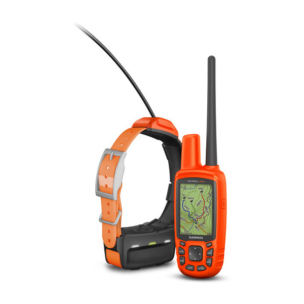
Here is some information and it shows all collars after the DC 50 will work including the TT 10.
KEY FEATURES:
NEW GPS/GLONASS
NEW PRELOADED MAPPING
NEW HIGH-VISIBLE DESIGN
NEW WEARABLES
NEW OPTIONAL BATTERY VIBRANT DISPLAY
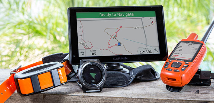
WIRELESS CONNECTIVITY
ADDITIONAL MAPPING
High-sensitivity GPS and GLONASS satellite reception has the ability to track in more challenging environments than GPS alone
Includes preloaded TOPO U.S. 100K mapping and a free 1-year BirdsEye Satellite Imagery subscription3
Vibrant orange design, making it difficult to lose in the field
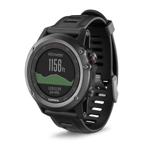
Receive dog status updates and alerts at-a-glance using your fēnix� 3 GPS watch
Optional in-unit rechargeable NiMH battery pack or uses standard AA battery power
Sunlight-readable, glove-friendly, 2.6-inch color display
Wirelessly connect to a variety of compatible Garmin devices, including VIRB� action cameras and ANT+� sensors, such as the tempeTM
microSDTM card slot and support for TOPO U.S. 24K, Garmin HuntViewTM, City Navigator�, Garmin Custom Maps and more (all sold separately)
NEW
EXPANDED DOG CAPABILITY
Track up to 20 dogs1 from a range of up to 9 miles2
NEW
FASTER UPDATE RATE
2.5-second update rate provides faster location tracking when dogs are on the run
NEW
HUNT METRICS
Hunt Metrics dog performance data shows distance traveled, time afield and more so you can train your dog more effectively
NEW
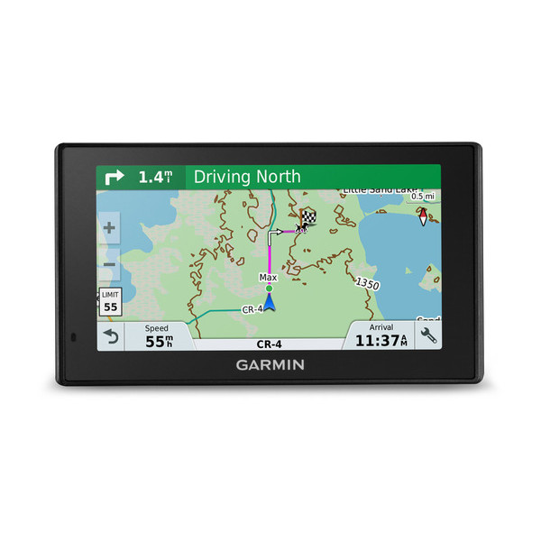
GARMIN DRIVETRACKTM 70 LMT
Compatible GPS navigator gives the driver a large 7-inch screen to see where dogs are located while navigating the trail (view more details on page 2)
NEW
COMPATIBLE DOG DEVICES
Compatible with a variety of dog devices: T 5, T 5 mini, TT 15, TT 15 mini, DC 50, TT 10 and newer models (provides tracking only)
NEW
DOG NOTIFICATIONS
Receive notifications when a dog is �Treed� or �On Point�
COMPASS/ALTIMETER
3-axis electronic compass and barometric altimeter
WATER RATING
Handheld device water-rated to IPX75
BASECAMPTM
Free trip-planning software that lets you view and organize maps, waypoints, routes, and tracks � and then share with friends, family or fellow explorers
__________________
www.ConkeysOutdoors.com
"Boss Lights"
Report this post to a moderator | IP: Logged
|


 06-16-2016 01:40 PM


